


Here's the view of Mount Whitney from the town of Lone Pine.
This photo was taken about 7:40 a.m. the day before the hike as we headed out to get our permit.
After snagging that all-important piece of paper we headed out for a warm-up hike on the nearby Meysan Lakes trail (another post when I get around to it).
We woke up at 3:00 a.m. on the day of the hike and hit the trail at 4:05 a.m.
Head lamps were necessary but the trail was well marked and easy to follow.
The weather was perfect, actually warm enough to wear shorts and just a light hiking shirt over my t-shirt.
The weather was perfect, actually warm enough to wear shorts and just a light hiking shirt over my t-shirt.
Click on any photo for a larger view.
 |
| It's an hour into the hike, 5:04 a.m. and the horizon is just starting to lighten. |

By 5:11 a.m. the horizon was quite a bit lighter and it was almost light enough to turn off the head lamps.

By 5:37 a.m. it was light enough to easily find our way without the head lamps.

We got to the permit restricted Whitney Zone at 5:49 a.m.
There was nobody there to check our permits.
Actually, we never met anybody who wanted to see our permits for the entire hike.
There was nobody there to check our permits.
Actually, we never met anybody who wanted to see our permits for the entire hike.
 |
5:58 a.m. and the sun is high enough to strike the peaks.

Looking down on Lone Pine Lake.

Wotan's Throne above Mirror Lake.

That's Thor Peak on the right, it's rises above Mirror Lake.


The trees disappear after you climb above Mirror Lake.
We hiked along Lone Pine Creek climbing towards Trail Camp.


Lone Pine Creek below Trail Camp.


Looking down along Lone Pine Creek, the trail is up on the left.

Consultation Lake, just below Trail Camp.

Trail Camp, 7:50 a.m. We are at 12,000 feet here.
Many hikers spend the night here before going on to the Whitney summit.
Many hikers spend the night here before going on to the Whitney summit.

A marmot hanging out around Trail Camp.

Dave starting up the 97, or so, switchbacks that start just above Trail Camp.

Only part way up the switchbacks looking down on Trail Camp
with Consultation lake to the right below.

The trail will take us behind the ridge.
The highest looking point is Mount Muir (14,018 ft/ 4273 m).
Whitney is on the far right at the end of the ridge.

That's Mount Muir up to the right behind Dave.
If you have the energy to climb it you can bag 2 "fourteeners" in one hike.
Not me.


8:33 a.m.
The bottom of the cable section, looking down the switchbacks.

Looking up the cable section towards Trail Crest.

The end of the cables.

Can you see the hikers on the switchbacks above?

Looking back again.

It's amazing to me what will grow and bloom at 12,800 feet.

Higher...

Slower...

The air is getting a bit thin...

Can you see the hiker on top of the ridge?

Perhaps you can see him now.
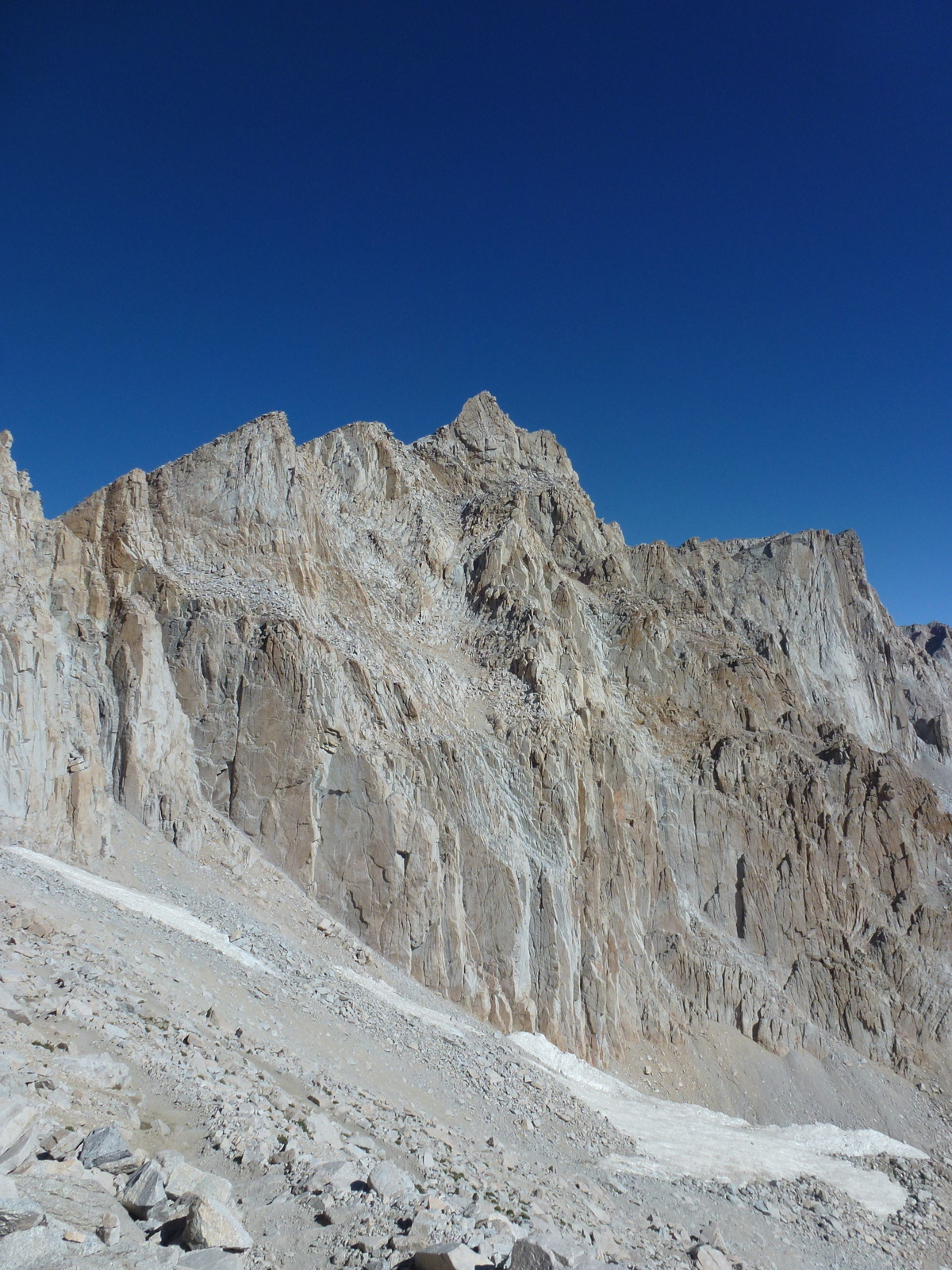
Mount Muir is in the center and Whitney is the seemingly lower flat topped peak to the right.

Trail Crest is now in sight. The trail starts around the back of ridge at that point.

9:27 a.m., 8.5 miles behind us, nearly 3 miles to go.
The Owens Valley seen from Trail Crest.

13,800 feet, don't know why the sign says 13,600.

Looking down the back side at one of the Hitchcock Lakes seen from Trail Crest.

Trail Camp and Consultation Lake are looking rather small now.

Dave took a break while waiting for me to catch up.

Hey, that's me in the photo for a change.

Hitchcock Lakes and Guitar Lake (right).

Looking back, you can see where the John Muir/Pacific Crest trail zig-zags up to intersect with the Mount Whitney trail.

Peering through one of the "windows" towards the Owens Valley.

The goal is in sight.
We had perfect weather for the hike.
Not too hot, nor too cold, barely a breeze.

Flowers still at 13,800 feet.

Dave (aka the Hare) once again waiting for me (aka the Tortoise).

Crook's Peak (right) and Keeler Needle (left).
They look so much more prominent when seen from the valley floor.

Ah ha, the Smithsonian Shelter finally comes in sight, nearly there...

11:28 a.m.
11.5 miles. 6,200 feet of climbing.
Whew, we made it.
Thank goodness (and lots of water) neither of us experienced any severe symptoms of altitude sickness, just a bit of a headache.

There are survey markers scattered all over the summit.
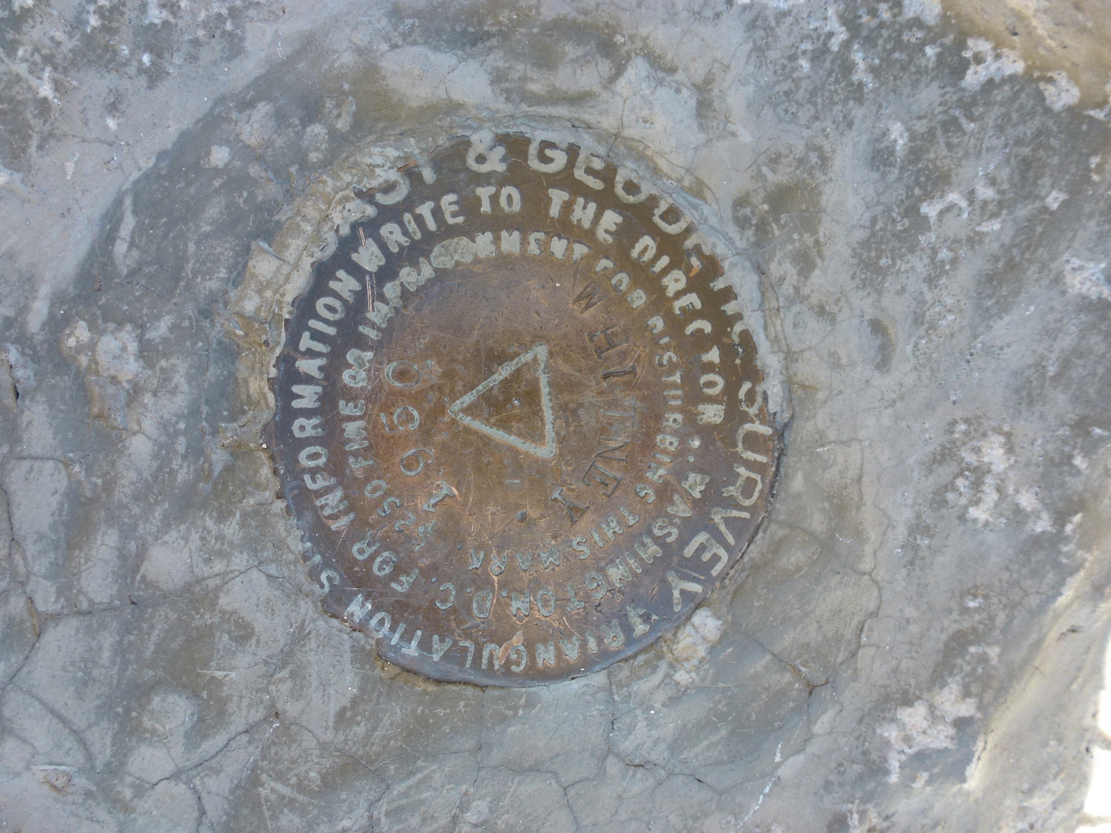
These are just a few.

HERE's the NGS data sheet that describes some of them.

A well deserved lunch break.
The weather was quite mild at the top.
There was just a bit of a cooling breeze which prompted me to put on a wind breaker.
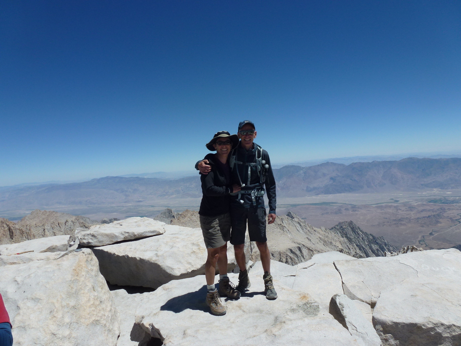
The summit memorial photo of the two of us.

Another marmot. He must be surviving on the crumbs from hiker's lunches.
He has to share with a few chipmunks as well.

You can see some of the first clouds forming as we start heading back down.
We were very fortunate, just 2 days before there were thunderstorms and hail.
The storms are very dangerous and cause for turning back if they come up before you make the summit. That's one reason why most day hikers start very early, some as early as midnight, to be sure to get to the summit by noon or earlier, before the thunderstorms tend to develop.

Looking back at the ridge that we hiked below to get here.
That's the side of Keeler Needle in front.

The wall of the Smithsonian Shelter above the registry box.
The shelter offers no protection from lightening in a thunderstorm,
the only protection is to get off the peak.

There were no blank sheets to sign so everyone just signed where they could find a space on an old sheet, including us.

The registry box is something of a shrine.

Time to leave. What a thrill it is to have made it to the highest point in the contiguous 48 states.

Keeler Needle and Crook's Peak.


Grrr, I don't like having to go up on the way down.


Say goodbye to Trail Crest.

Looking back.
Wow, we were really there!

There are still a few late comers at the top.

My lungs are happy that I'm going down the switchbacks,
but my knees aren't.

It was barely light when we passed Mirror Lake in the morning.
That's Thor Peak rising above it.

Bighorn Park, further down the trail.

We crossed this log bridge in the dark of the morning.

Nearly back down to the trailhead and the end of the hike.
 |
6:27 p.m.
21.5 miles round trip.
6700 feet total elevation gain.
The end (and the beginning) and one tired but happy hiker.
If you would like to see more photos from this hike you can see them HERE on my Picasa web album.
love the pics and the blog. can't wait to hear more about the trip! cynthia
ReplyDeletevery sweet pics and good reference and info!! Thank you for sharing!!
ReplyDelete